285 1800's
CATEGORY
PRICE
SIZE
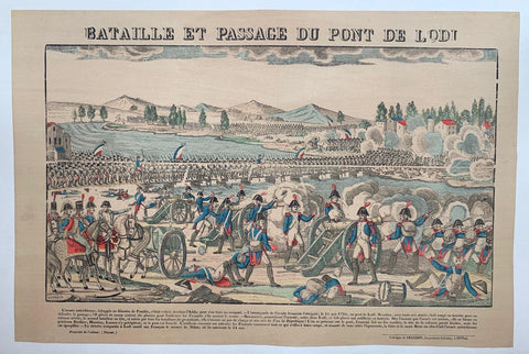
Bataille et Passage du Pont de Lodi Product Link
Epinal, C. 1880
16 x 25 in (41 x 64 cm)
$200
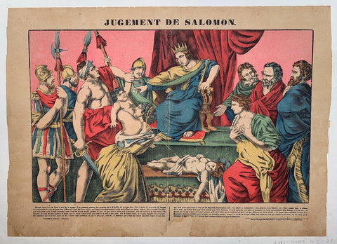
Jugement De Salomon Product Link
Epinal, C. 1880
16 x 25 in (41 x 64 cm)
$200
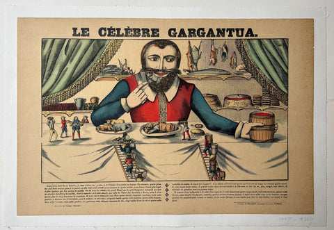
Le Celebre Gargantua Product Link
Epinal, C. 1880
16 x 25 in (41 x 64 cm)
$200
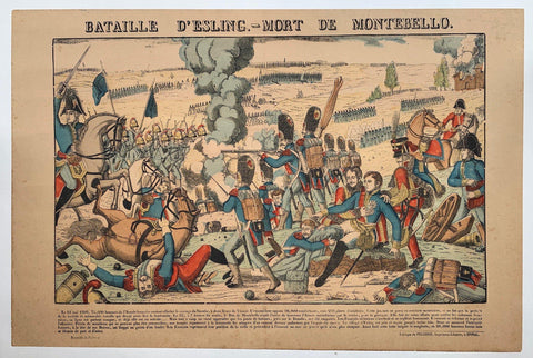
Bataille D'essling - Mort De Montebello Product Link
Epinal, C. 1885
16 x 25 in (41 x 64 cm)
$200
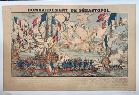
Bombardement de Sebastopol Product Link
Epinal, C. 1880
16 x 25 in (41 x 64 cm)
$200

Bataillle D'Iéna Product Link
Epinal, C. 1880
16 x 25 in (41 x 64 cm)
$200

Passage de la Beresina Product Link
Epinal, C. 1880
16 x 25 in (41 x 64 cm)
$200
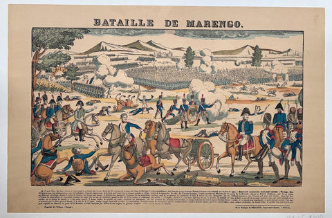
Bataille de Marengo Product Link
Epinal, C. 1880
16 x 25 in (41 x 64 cm)
$200
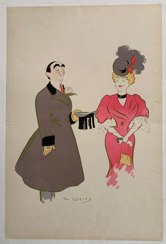
De Losques ✓ Product Link
France, C. 1895
20 x 14 in (51 x 36 cm)
$150
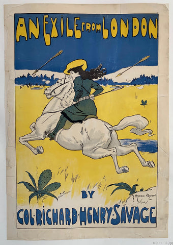
An Exile From London ✓ Product Link
London, C. 1896
24 x 17 in (61 x 43 cm)
$175

Mc Clure's For February Abraham Lincoln ✓ Product Link
USA, 1896
22 x 15 in (56 x 38 cm)
$250
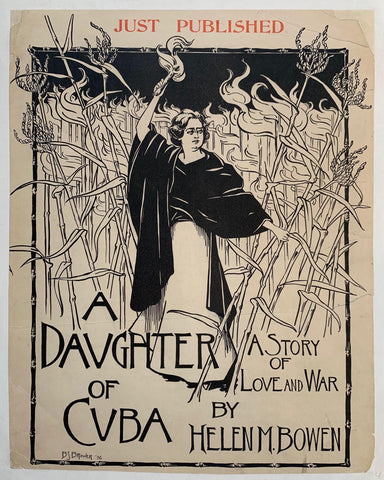
A Daughter of Cuba Poster ✓ Product Link
USA, 1896
19 x 15 in (48 x 38 cm)
$250

Biscuits Guillout Product Link
France, C. 1895
17 x 24 in (43 x 61 cm)
$150

Une Bonne Âme Product Link
France, C. 1892
17 x 14 in (43 x 36 cm)
$150

Vin Sautel Au Grenache Vieux... Product Link
France, C. 1895
12 x 16 in (30 x 41 cm)
$140

C.J. Ashton General Blacksmith ✓ Product Link
New York, C. 1895
15 x 20 in (38 x 51 cm)
$250
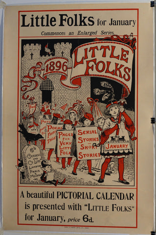
Little Folks for January Commences an Enlarged Series 1896 Product Link
Sweden, C. 1895
20 x 30 in (51 x 76 cm)
$250

La Roue Quinzaine Commerciale Commerçant Participant Product Link
France, C. 1895
12 x 16 in (30 x 41 cm)
$120

Publisher Childrens Books Topsys and Turvys Product Link
1894
21 x 29 in (53 x 74 cm)
$175

Parade of Locomotion Product Link
c.1895
9 x 31 in (22 x 79 cm)
$200
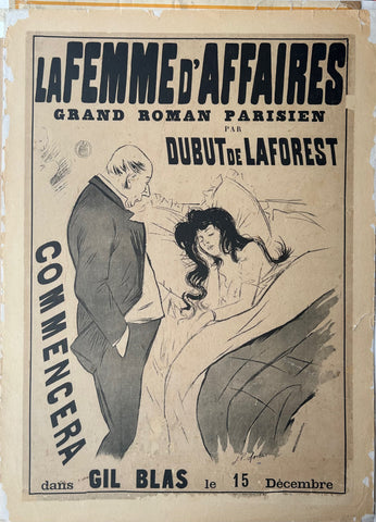
La Femme d'Affaires Poster Product Link
France, c. 1890
24 x 33 in (60 x 84 cm)
$250

The state of New Jersey Product Link
U.S.A 1887
27 x 37 in (68 x 94 cm)
$160

A Topographical Map of the Vicinity of Salem Product Link
U.S.A 1887
27 x 37 in (68 x 94 cm)
$160
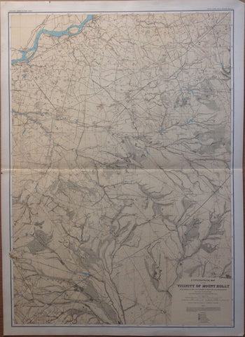
A Topographical Map of the Vicinity of Mount Holly Product Link
U.S.A 1887
27 x 37 in (68 x 94 cm)
$160

New Jersey Product Link
U.S.A 1887
27 x 37 in (68 x 94 cm)
$160

A Topographical Map of the Southern Interior Product Link
U.S.A 1887
27 x 37 in (68 x 94 cm)
$160
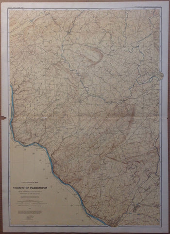
A Topographical Map of the Vicinity of Flemington Product Link
U.S.A 1887
27 x 37 in (68 x 94 cm)
$160
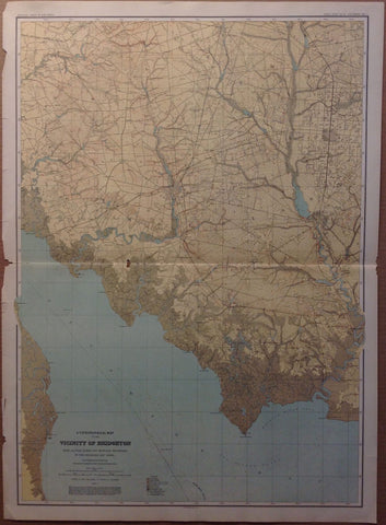
A Topographical Map of the Vicinity of Bridgeton Product Link
U.S.A 1887
27 x 37 in (68 x 94 cm)
$160

A Topographical Map of the Central Highlands Product Link
U.S.A 1887
27 x 37 in (68 x 94 cm)
$160
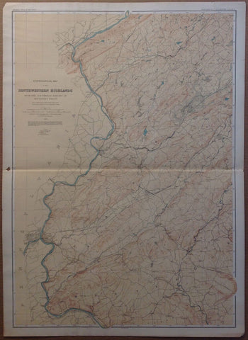
A Topographical Map of the Southwestern Highlands Product Link
U.S.A 1887
27 x 37 in (68 x 94 cm)
$160

A Topographical Map of Kittatinny Valley and Mountain Product Link
U.S.A 1887
27 x 37 in (68 x 94 cm)
$160

Boulogne, Seine Fleuve, Suresnes & St. Cloud ✓ Product Link
France c. 1872
27 x 36 in (67 x 91 cm)
$200

Fort de Romainville ✓ Product Link
France c. 1872
27 x 36 in (67 x 91 cm)
$200

Courbevoie to Sablonville ✓ Product Link
France c. 1872
27 x 36 in (67 x 91 cm)
$200

Bois De Vincennes & Fort de Charenton ✓ Product Link
France c. 1872
27 x 36 in (67 x 91 cm)
$200

Fort D'Ivry & Seine Fleuve ✓ Product Link
France c. 1872
27 x 36 in (67 x 91 cm)
$200

Gentilly & Fort de Bicêtre ✓ Product Link
France c. 1872
27 x 36 in (67 x 91 cm)
$200

Montrouge ✓ Product Link
France c. 1872
27 x 36 in (67 x 91 cm)
$200

Bois de Meudon ✓ Product Link
France c. 1872
27 x 36 in (67 x 91 cm)
$200

Fontenay & Fort de Rosny ✓ Product Link
France c. 1872
27 x 36 in (67 x 91 cm)
$200

Village of North Dighton Product Link
U.S.A 1895
33 x 23 in (83 x 57 cm)
$150
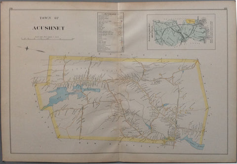
Town of Acushnet Product Link
U.S.A 1895
33 x 23 in (83 x 57 cm)
$150
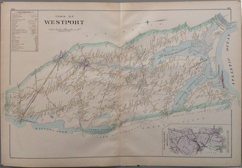
Town of Westport Product Link
U.S.A 1895
33 x 23 in (83 x 57 cm)
$150
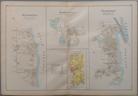
Pottersville, Swansea Village and Somerset Product Link
U.S.A 1895
33 x 23 in (83 x 57 cm)
$150
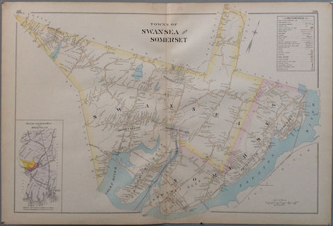
Towns of Swansea and Somerset Product Link
U.S.A 1895
33 x 23 in (83 x 57 cm)
$150

Town of Mansfield Product Link
U.S.A 1895
33 x 23 in (83 x 57 cm)
$150
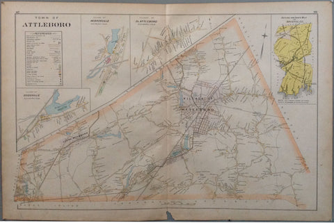
Town of Attleboro Product Link
U.S.A 1895
33 x 23 in (83 x 57 cm)
$150

Town of North Attleboro - Attleboro Falls Product Link
U.S.A 1895
33 x 23 in (83 x 57 cm)
$150

Mill River/Mayflower Cemetery - Part of city of Taunton Product Link
U.S.A 1895
33 x 23 in (83 x 57 cm)
$150
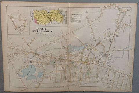
North Attleboro Product Link
U.S.A 1895

