350 1920's
CATEGORY
PRICE
SIZE
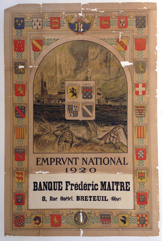
Emprunt National 1920 -- Banque Frederi Maitre Product Link
1920
31 x 47 in (79 x 119 cm)
$225
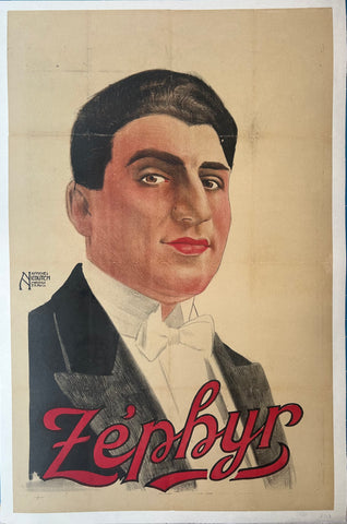
Zephyr Poster ✓ Product Link
France, c. 1920
25 x 38 in (64 x 97 cm)
$250

Die Ginnahme Jerichos Poster ✓ Product Link
Germany, c. 1920
23 x 35 in (58 x 89 cm)
$250
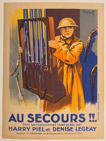
Au Secours !! Film Poster Product Link
France, 1924
24 x 32 in (61 x 81 cm)
$225
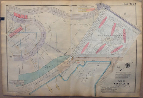
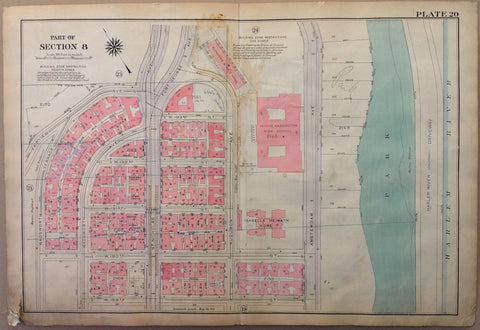
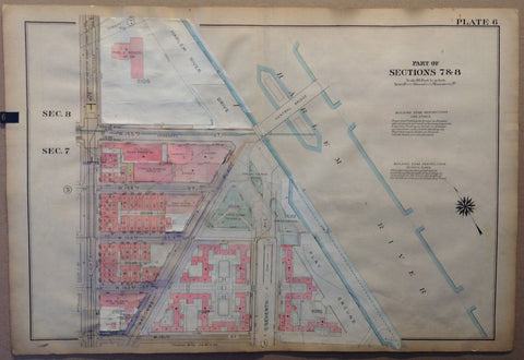
NYC Bronx Map - Part of Section 8, Sherman's Creek Product Link
U.S.A c. 1921
32 x 22 in (81 x 56 cm)
$200
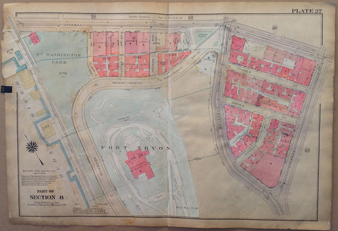
NYC Bronx Map - Part of Section 8, Fort Tryon Product Link
U.S.A c. 1921
32 x 22 in (81 x 56 cm)
$200

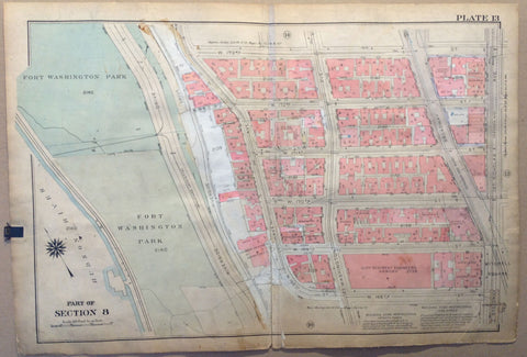
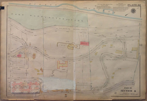
NYC Bronx Map - Part of Section 8, Hudson River, Fort Washington Park & Riverside Product Link
U.S.A c. 1921
32 x 22 in (81 x 56 cm)
$200
NYC Bronx Map - Part of Section 8, Dyckman Theatre, Tenth Ave & Sherman Ave Product Link
U.S.A c. 1921
32 x 22 in (81 x 56 cm)
$200
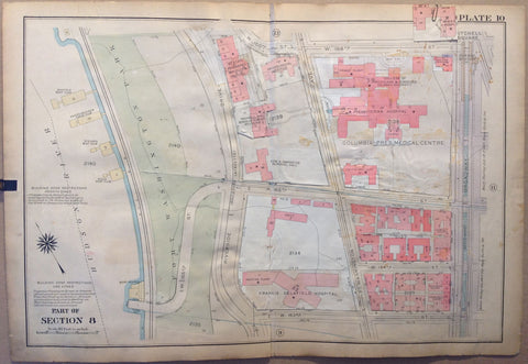
NYC Bronx Map - Part of Section 8, George Washington High School, Park, Harlem River Product Link
U.S.A c. 1921
32 x 22 in (81 x 56 cm)
$200
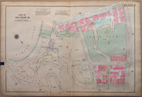
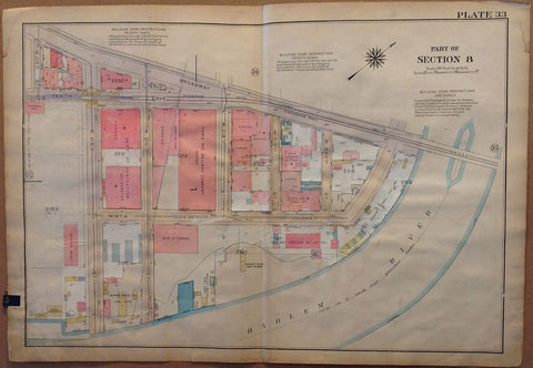
NYC Bronx Map - Part of Section 8, Harlem River, Payson ave & Isham Park Product Link
U.S.A c. 1921
32 x 22 in (81 x 56 cm)
$200
NYC Bronx Map - Part of Section 8, Fort Washington Park, Hudson River & Riverside Drive Product Link
U.S.A c. 1921
32 x 22 in (81 x 56 cm)
$200
NYC Bronx Map - Part of Section 8, Inwood Park, Harlem River & Hudson River Product Link
U.S.A c. 1921
32 x 22 in (81 x 56 cm)
$200
NYC Bronx Map - Part of Section 8, Harlem River & Dykman Houses Product Link
U.S.A c. 1921
32 x 22 in (81 x 56 cm)
$200
NYC Bronx Map - Part of Section 8, Fort Washington Park & Hudson River Product Link
U.S.A c. 1921
32 x 22 in (81 x 56 cm)
$200
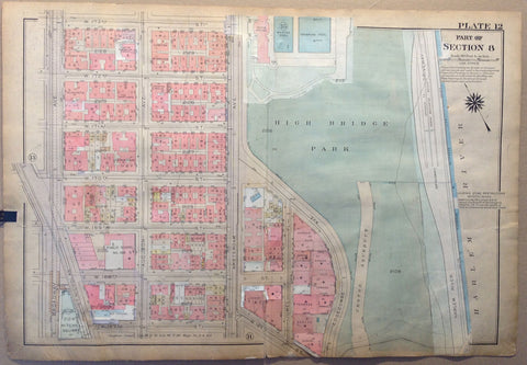
NYC Bronx Map - Part of Section 8, Highbridge Park & Harlem River Product Link
U.S.A c. 1921
32 x 22 in (81 x 56 cm)
$200
NYC Bronx Map - Part of Section 8, Highbridge Park & Harlem River Product Link
U.S.A c. 1921
32 x 22 in (81 x 56 cm)
$200
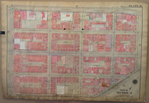
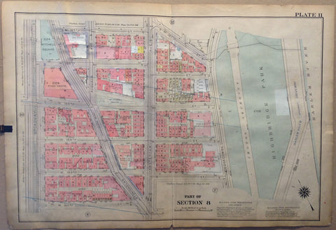
NYC Bronx Map - Part of Section 8, Broadway & Amsterdam Product Link
U.S.A c. 1921
32 x 22 in (81 x 56 cm)
$200
NYC Bronx Map - Part of Section 8, Broadway & Harlem River Product Link
U.S.A c. 1921
32 x 22 in (81 x 56 cm)
$200
NYC Bronx Map - Part of Sections 7 & 8, Harlem River & Central Bridge Product Link
U.S.A c. 1921
32 x 22 in (81 x 56 cm)
$200
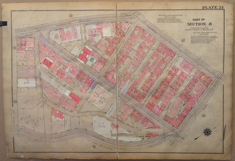
NYC Bronx Map - Part of Section 8, St. Nicholas, Hillside, Nagle & Broadway Product Link
U.S.A c. 1921
32 x 22 in (81 x 56 cm)
$200
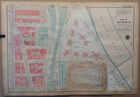
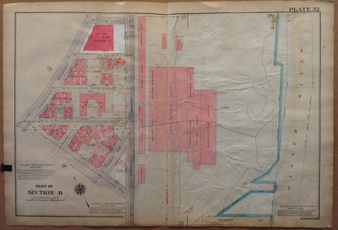
NYC Bronx Map - Part of Section 8, Highbridge Park, Croton Aqueduct & Polo Grounds Product Link
U.S.A c. 1921
32 x 22 in (81 x 56 cm)
$200
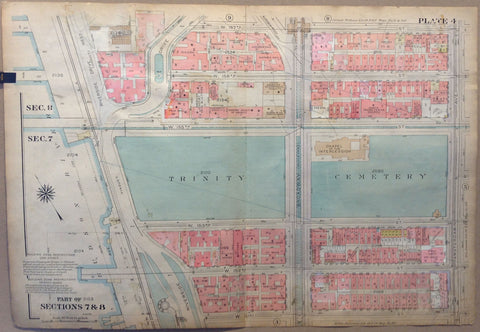
NYC Bronx Map - Part of Sections 7 & 8, Trinity Cemetery Product Link
U.S.A c. 1921
32 x 22 in (81 x 56 cm)
$200
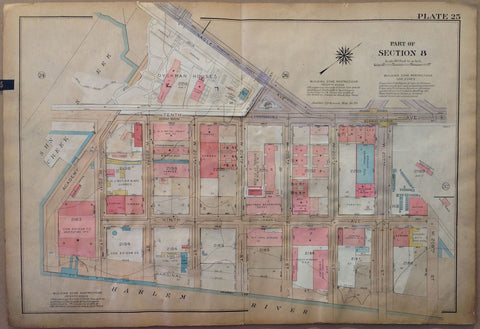
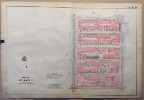
NYC Bronx Map - Part of Section 8, Harlem River Product Link
U.S.A c. 1921
32 x 22 in (81 x 56 cm)
$200
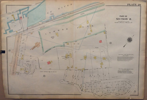
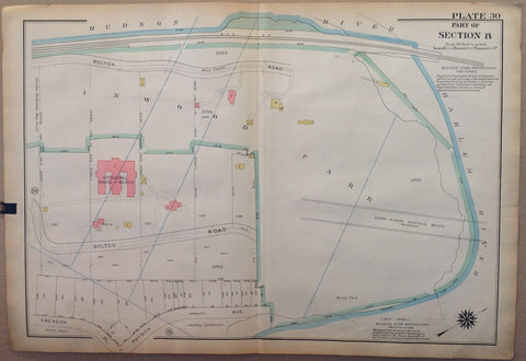
NYC Bronx Map - Part of Section 8, Inwood Park Product Link
U.S.A c. 1921
32 x 22 in (81 x 56 cm)
$200
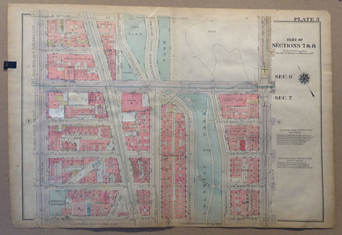
NYC Bronx Map - Part of Sections 7 & 8 Product Link
U.S.A c. 1921
32 x 22 in (81 x 56 cm)
$200
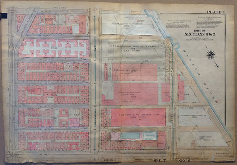
NYC Bronx Map - Part of Sections 6 and 7, Interborough Rapid Transit Car Yard Product Link
U.S.A c. 1921
32 x 22 in (81 x 56 cm)
$200
NYC Bronx Map - Part of Section 8, Fort Washington Park Product Link
U.S.A c. 1921
32 x 22 in (81 x 56 cm)
$200
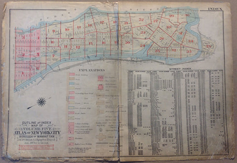
Outline and Index Map of New York City, The Bronx Product Link
U.S.A c. 1921
32 x 22 in (81 x 56 cm)
$200

Il Monello Product Link
Italy, 1921
39 x 55 in (99 x 140 cm)
$200
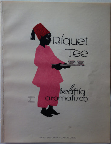
Riquet Tee Product Link
Germany c. 1926
9 x 12 in (23 x 30 cm)
$120
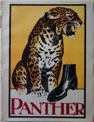
Panther Product Link
Germany c. 1926
9 x 12 in (23 x 30 cm)
$120
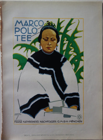
Marco Polo Tee Product Link
Germany c. 1926
9 x 12 in (23 x 30 cm)
$120
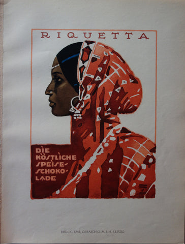
Riquetta Product Link
Germany c. 1926
9 x 12 in (23 x 30 cm)
$120

Riquet Ludana schokolade Product Link
Germany c. 1926
9 x 12 in (23 x 30 cm)
$120
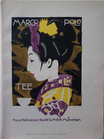
Marco Polo Product Link
Germany c. 1926
9 x 12 in (23 x 30 cm)
$120

Carl Mauer Remscheid Product Link
Germany c. 1926
9 x 12 in (23 x 30 cm)
$110

Gekrum Product Link
Germany c. 1926
9 x 12 in (23 x 30 cm)
$120
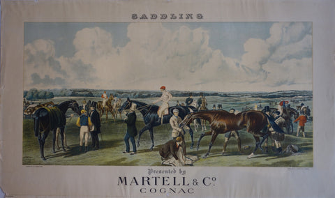
Saddling Product Link
France 1920
19 x 26 in (48 x 66 cm)
$250
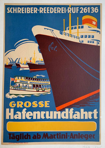
Grosse Hafenrundfahrt -- Täglich ab Martini-Anleger Product Link
c.1920
13 x 20 in (33 x 51 cm)
$225
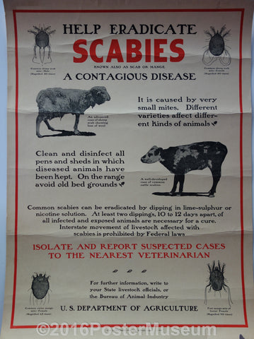
Help eradicate scabies Product Link
United States - 1928
15 x 20 in (38 x 51 cm)
$125
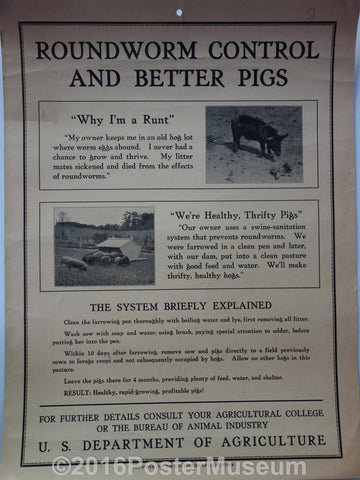
Roundworm control and better pigs Product Link
United States - 1928
15 x 20 in (38 x 51 cm)
$125

The common sheep liver flukes Product Link
United States - 1928
15 x 20 in (38 x 51 cm)
$125
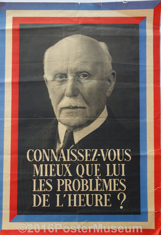
Connaissez-Vous Mieux Que Lui Les Problemes De L'Heure? Product Link
France c. 1920
14 x 20 in (36 x 50 cm)
$200

Jock Whiteford The Smart Scot Product Link
Circa 1920's
20 x 30 in (51 x 76 cm)
$200

If Four Walls Told Product Link
UK c. 1920's
20 x 30 in (51 x 76 cm)
$200

Seats Can Now Be Booked Product Link
Circa 1920's
20 x 30 in (51 x 76 cm)
$125
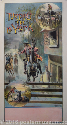
Turpin's Ride to York ✓ Product Link
Circa 1920's
20 x 30 in (51 x 76 cm)
$250

Herbert Mansfield Product Link
Circa 1920
20 x 30 in (51 x 76 cm)
$200
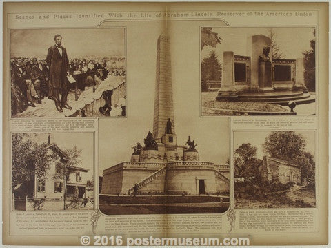
Abraham Lincoln, Preserver of the American Union Product Link
United States - 1923
16 x 22 in (41 x 55 cm)
$150
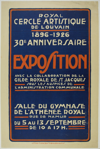
Royal Cercle Artistique de Louvain ✓ Product Link
France - 1926

