51 All Posters
CATEGORY
PRICE
SIZE
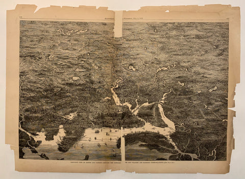
Harper's Weekly Centerfold Product Link
U.S.A., 1871
22 x 17 in (56 x 43 cm)
$95
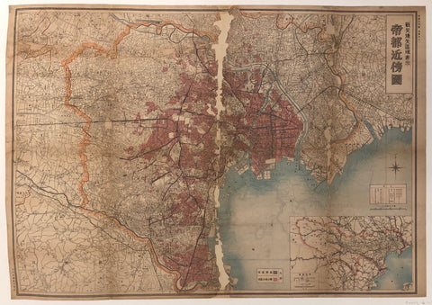
Map of Tokyo ✓ Product Link
Japan, c. 1930
30 x 42 in (76 x 107 cm)
$400
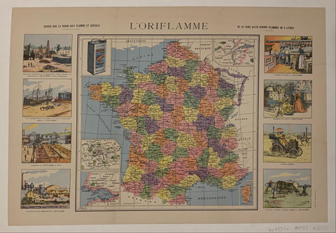
L'Oriflamme ✓ Product Link
France
23 x 16 in (58 x 41 cm)
$300
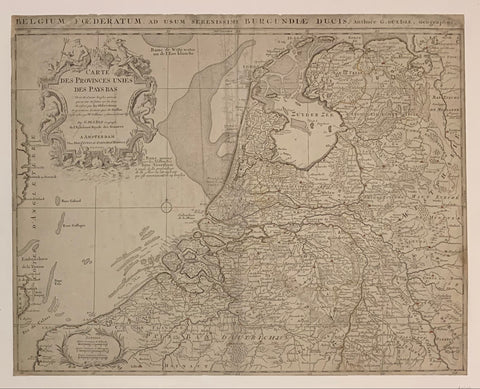
Carte Des Provinces Unies Des Pays Bas Map ✓ Product Link
France, c. 1700
21 x 24 in (53 x 61 cm)
$400

The state of New Jersey Product Link
U.S.A 1887
27 x 37 in (68 x 94 cm)
$160

A Topographical Map of the Vicinity of Salem Product Link
U.S.A 1887
27 x 37 in (68 x 94 cm)
$160
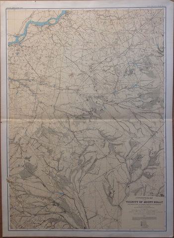
A Topographical Map of the Vicinity of Mount Holly Product Link
U.S.A 1887
27 x 37 in (68 x 94 cm)
$160

New Jersey Product Link
U.S.A 1887
27 x 37 in (68 x 94 cm)
$160

A Topographical Map of the Southern Interior Product Link
U.S.A 1887
27 x 37 in (68 x 94 cm)
$160
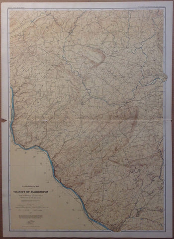
A Topographical Map of the Vicinity of Flemington Product Link
U.S.A 1887
27 x 37 in (68 x 94 cm)
$160
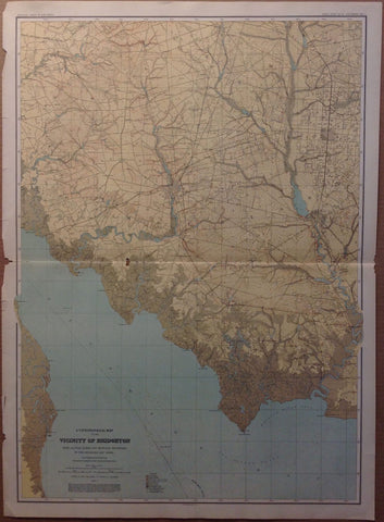
A Topographical Map of the Vicinity of Bridgeton Product Link
U.S.A 1887
27 x 37 in (68 x 94 cm)
$160

A Topographical Map of the Central Highlands Product Link
U.S.A 1887
27 x 37 in (68 x 94 cm)
$160
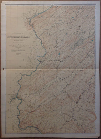
A Topographical Map of the Southwestern Highlands Product Link
U.S.A 1887
27 x 37 in (68 x 94 cm)
$160

A Topographical Map of Kittatinny Valley and Mountain Product Link
U.S.A 1887
27 x 37 in (68 x 94 cm)
$160

Village of North Dighton Product Link
U.S.A 1895
33 x 23 in (83 x 57 cm)
$150
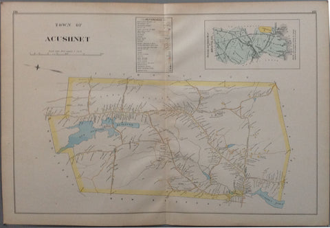
Town of Acushnet Product Link
U.S.A 1895
33 x 23 in (83 x 57 cm)
$150
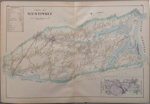
Town of Westport Product Link
U.S.A 1895
33 x 23 in (83 x 57 cm)
$150
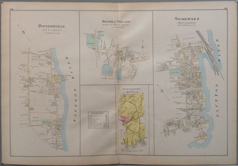
Pottersville, Swansea Village and Somerset Product Link
U.S.A 1895
33 x 23 in (83 x 57 cm)
$150
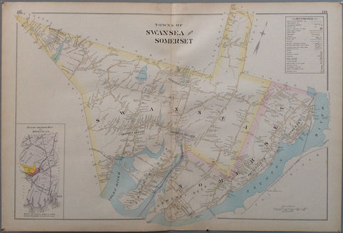
Towns of Swansea and Somerset Product Link
U.S.A 1895
33 x 23 in (83 x 57 cm)
$150

Town of Mansfield Product Link
U.S.A 1895
33 x 23 in (83 x 57 cm)
$150
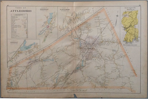
Town of Attleboro Product Link
U.S.A 1895
33 x 23 in (83 x 57 cm)
$150

Town of North Attleboro - Attleboro Falls Product Link
U.S.A 1895
33 x 23 in (83 x 57 cm)
$150

Mill River/Mayflower Cemetery - Part of city of Taunton Product Link
U.S.A 1895
33 x 23 in (83 x 57 cm)
$150
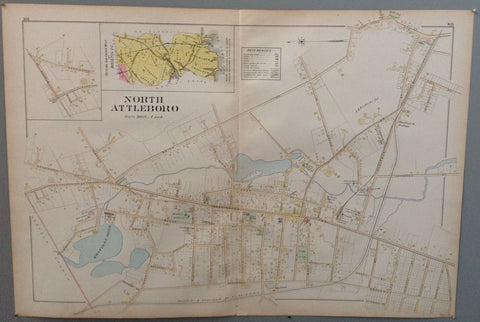
North Attleboro Product Link
U.S.A 1895
33 x 23 in (83 x 57 cm)
$150

Lunatic Hospital - Part of city of Taunton Product Link
U.S.A 1895
33 x 23 in (83 x 57 cm)
$150
Part of city of Taunton Product Link
U.S.A 1895
33 x 23 in (83 x 57 cm)
$150

City of Taunton - Westerly part Product Link
U.S.A 1895
33 x 23 in (83 x 57 cm)
$150

Taunton River - part of city of Taunton Product Link
U.S.A 1895
33 x 23 in (83 x 57 cm)
$150

Village of Attleboro Product Link
U.S.A 1895
33 x 23 in (83 x 57 cm)
$150

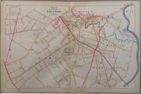
City of Taunton Product Link
U.S.A 1895
33 x 23 in (83 x 57 cm)
$150

Fair Haven Product Link
U.S.A 1895
33 x 23 in (83 x 57 cm)
$150

Acushnet River - Part of city of New Bedford Product Link
U.S.A 1895
33 x 23 in (83 x 57 cm)
$150

Mount Hope Bay - Part of city of Fall River Product Link
U.S.A 1895
33 x 23 in (83 x 57 cm)
$150

Ward 2,3,4 and 5 - Part of city of New Bedford Product Link
U.S.A 1895
33 x 23 in (83 x 57 cm)
$150

Town of Freetown Product Link
U.S.A 1895
33 x 23 in (83 x 57 cm)
$150

Clark's Point - part of city of New Bedford Product Link
U.S.A 1895
33 x 23 in (83 x 57 cm)
$150

Quequechan River - Part of city of Fall River Product Link
U.S.A 1895
33 x 23 in (83 x 57 cm)
$150

South Watuppa Pond - Part of city of Fall River Product Link
U.S.A 1895
33 x 23 in (83 x 57 cm)
$150

Town of Fair Haven Product Link
U.S.A 1895
33 x 23 in (83 x 57 cm)
$150

Taunton River - Part of city of Fall River Product Link
U.S.A 1895
33 x 23 in (83 x 57 cm)
$150

Town of Rehoboth Product Link
U.S.A 1895
33 x 23 in (83 x 57 cm)
$150

Town of Seekonk Product Link
U.S.A 1895
33 x 23 in (83 x 57 cm)
$150

town of Berkley Product Link
U.S.A 1895
33 x 23 in (83 x 57 cm)
$150

Town of Raynham Product Link
U.S.A 1895
33 x 23 in (83 x 57 cm)
$150

Village of North Easton Product Link
U.S.A 1895
33 x 23 in (83 x 57 cm)
$150

Town of Dighton Product Link
U.S.A 1895
33 x 23 in (83 x 57 cm)
$150

Town of Norton Product Link
U.S.A 1895
33 x 23 in (83 x 57 cm)
$150

City of New Bedford Product Link
U.S.A 1895
33 x 23 in (83 x 57 cm)
$150

Steep Brook - Fall River Product Link
U.S.A 1895
33 x 23 in (83 x 57 cm)
$150

Town of Easton Product Link
U.S.A 1895

