12 Boats

NOTE: For close-up of condition, double-click the image
Link to  NOAA Cohasset and Scituate Harbors MapU.S.A., 1975  Product
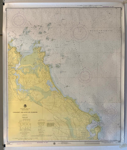
NOAA Cohasset and Scituate Harbors Map Product Link
U.S.A., 1975
42 x 35 in (107 x 89 cm)
$200
Link to  NOAA Charleston Harbor and Approaches MapU.S.A., 1962  Product
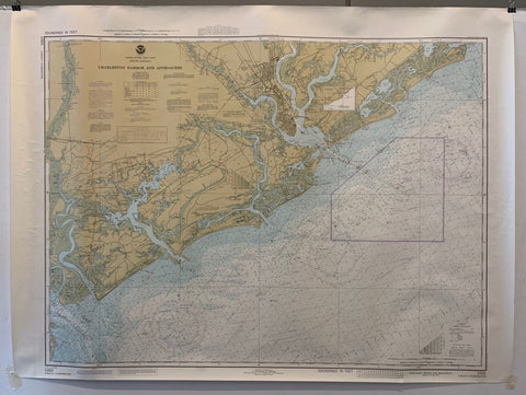
NOAA Charleston Harbor and Approaches Map Product Link
U.S.A., 1962
36 x 44 in (91 x 112 cm)
$200
Link to  NOAA Little River Inlet to Winyah Bay Entrance MapU.S.A., 1979  Product
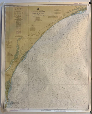
NOAA Little River Inlet to Winyah Bay Entrance Map Product Link
U.S.A., 1979
36 x 44 in (91 x 112 cm)
$200
Link to  NOAA Cape Cod Canal and Approaches MapU.S.A., 1979  Product
NOAA Cape Cod Canal and Approaches Map Product Link
U.S.A., 1979
36 x 44 in (91 x 112 cm)
$200
Link to  NOAA Narrangansett Bay MapU.S.A., 1979  Product
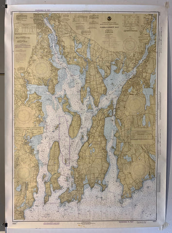
NOAA Narrangansett Bay Map Product Link
U.S.A., 1979
44 x 36 in (112 x 91 cm)
$200
Link to  NOAA Fishers Island Sound MapU.S.A., 1979  Product
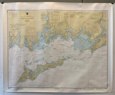
NOAA Fishers Island Sound Map Product Link
U.S.A., 1979
37 x 45 in (94 x 114 cm)
$200
Link to  NOAA Approaches to Cape Fear River MapU.S.A., 1979  Product
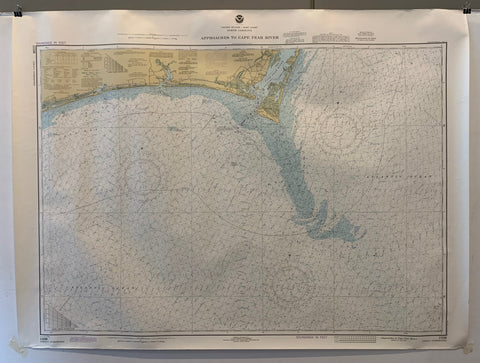
NOAA Approaches to Cape Fear River Map Product Link
U.S.A., 1979
37 x 45 in (94 x 114 cm)
$200
Link to  NOAA Cape Lookout to New River MapU.S.A., 1981  Product
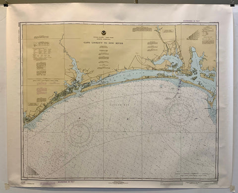
NOAA Cape Lookout to New River Map Product Link
U.S.A., 1981
37 x 45 in (94 x 114 cm)
$200
Link to  NOAA Block Island Sound MapU.S.A., 1980  Product
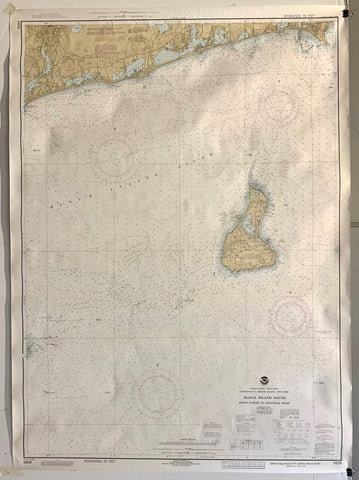
NOAA Block Island Sound Map Product Link
U.S.A., 1980
36 x 50 in (91 x 127 cm)
$200
Link to  NOAA Oyster and Huntington Bays MapU.S.A., 1979  Product
NOAA Oyster and Huntington Bays Map Product Link
U.S.A., 1979
36 x 50 in (91 x 127 cm)
$200
Link to  NOAA Long Island Sound and East River MapU.S.A., 1979  Product
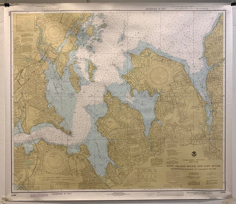
NOAA Long Island Sound and East River Map Product Link
U.S.A., 1979
36 x 50 in (91 x 127 cm)
$200
Link to  NOAA North Shore of Long Island Sound MapU.S.A., 1979  Product
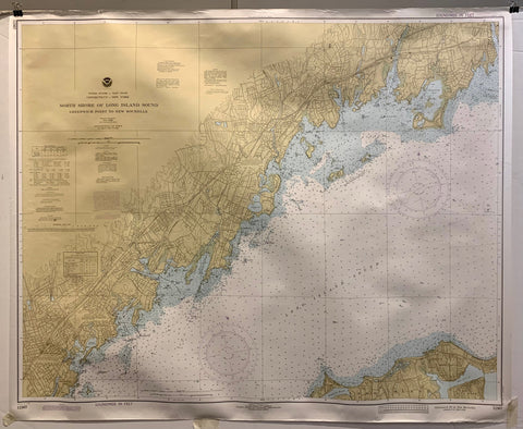
NOAA North Shore of Long Island Sound Map Product Link
U.S.A., 1979
36 x 50 in (91 x 127 cm)
$200