26 Horizontal
CATEGORY
PRICE
SIZE

Das Neue Europa Product Link
Austria, 1919
37 x 48 in (94 x 122 cm)
$1,600

Plan de Paris à vol d'oiseau Product Link
France, 1974
69 x 47 in (175 x 119 cm)
$275

Une Course d'Automobiles à Travers La Belgique Product Link
France, c. 1920s
18 x 21 in (46 x 53 cm)
$125

Conterminous United States Product Link
USA, 1973
29 x 41 in (74 x 104 cm)
$150

Air France Product Link
France, C.1950's
30 x 43 in (76 x 109 cm)
$2,200

La Belgique par Provinces Product Link
France, C.1920's
9 x 12 in (23 x 30 cm)
$90

Map of the Burlington Route Product Link
U.S.A., C.1890's
15 x 18 in (38 x 46 cm)
$90

La Vallée de la Dordogne Product Link
France, 1948
32 x 47 in (81 x 119 cm)
$600

The Misguided Product Link
France C. 1910
26 x 95 in (66 x 241 cm)
$6,000
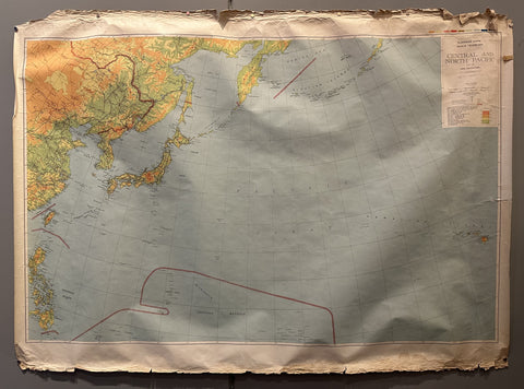
Map of Central and North Pacific Region Product Link
USA, 1943
44 x 59 in (112 x 150 cm)
$150
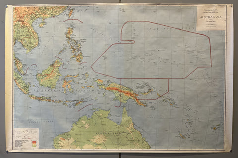
Map of Australasia Product Link
USA, 1943
38 x 58 in (97 x 147 cm)
$150
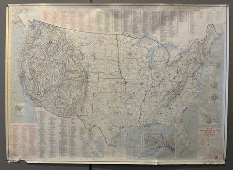
Major Army, Navy and Air Force Installations in the United States Product Link
USA, 1980
35 x 45 in (89 x 114 cm)
$150

Air France Map Summer 1952 Product Link
France, 1952
21 x 31 in (53 x 79 cm)
$250
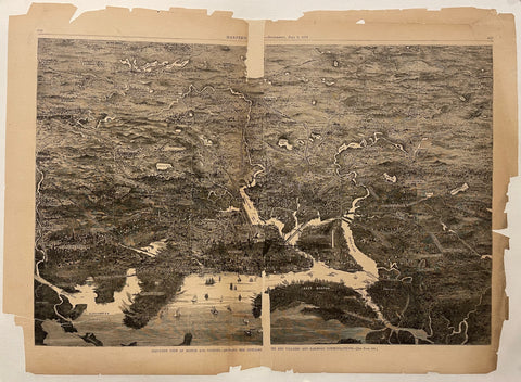
Harper's Weekly 1871 Print Product Link
U.S.A., 1871
17 x 22 in (43 x 56 cm)
$95
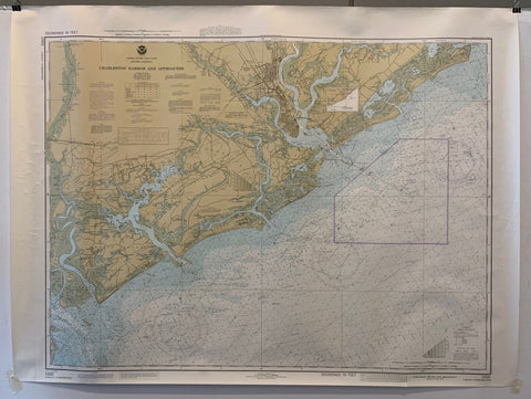
NOAA Charleston Harbor and Approaches Map Product Link
U.S.A., 1962
36 x 44 in (91 x 112 cm)
$200
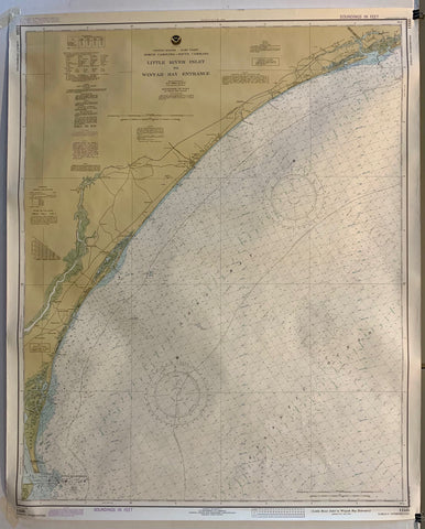
NOAA Little River Inlet to Winyah Bay Entrance Map Product Link
U.S.A., 1979
36 x 44 in (91 x 112 cm)
$200
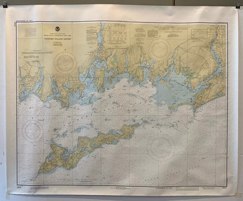
NOAA Fishers Island Sound Map Product Link
U.S.A., 1979
37 x 45 in (94 x 114 cm)
$200
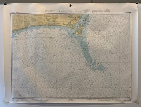
NOAA Approaches to Cape Fear River Map Product Link
U.S.A., 1979
37 x 45 in (94 x 114 cm)
$200
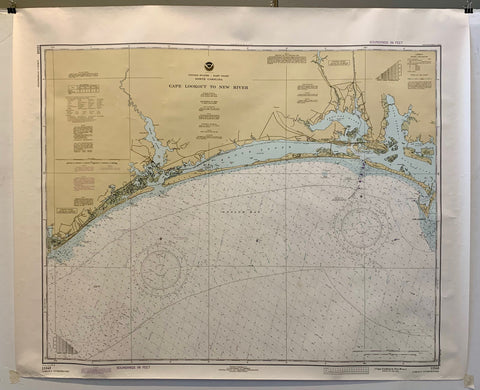
NOAA Cape Lookout to New River Map Product Link
U.S.A., 1981
37 x 45 in (94 x 114 cm)
$200
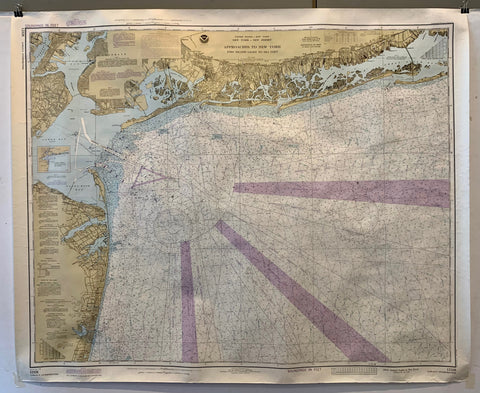
NOAA Approaches to New York Map Product Link
U.S.A., 1979
36 x 48 in (91 x 122 cm)
$200
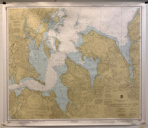
NOAA Long Island Sound and East River Map Product Link
U.S.A., 1979
36 x 50 in (91 x 127 cm)
$200
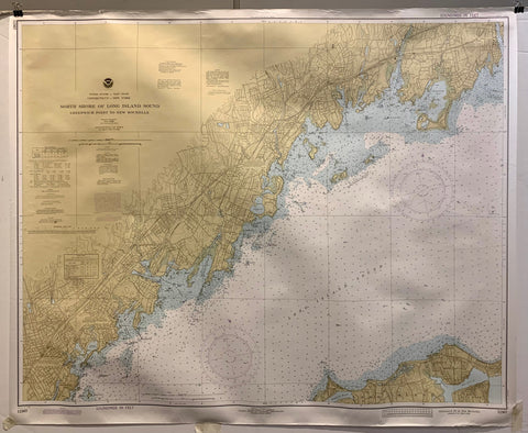
NOAA North Shore of Long Island Sound Map Product Link
U.S.A., 1979
36 x 50 in (91 x 127 cm)
$200
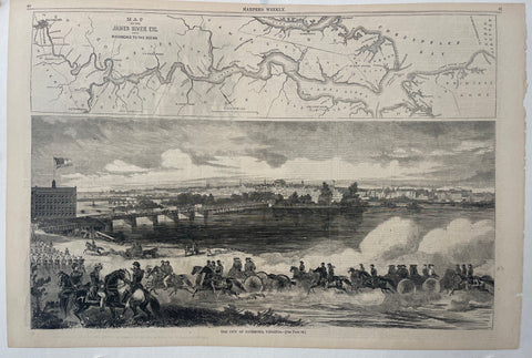
Harper's Weekly 'Richmond, Virginia' Product Link
U.S.A., 1862
22 x 15 in (56 x 38 cm)
$150
Harper's Weekly Centerfold Product Link
U.S.A., 1871
22 x 17 in (56 x 43 cm)
$95

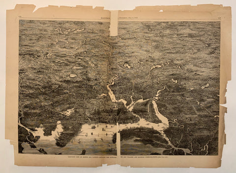
Harper's Weekly, 26 April 1862 Product Link
U.S.A., 1862
15 x 11 in (38 x 28 cm)
$40

Air France Flight Map Poster Product Link
France, 1953

