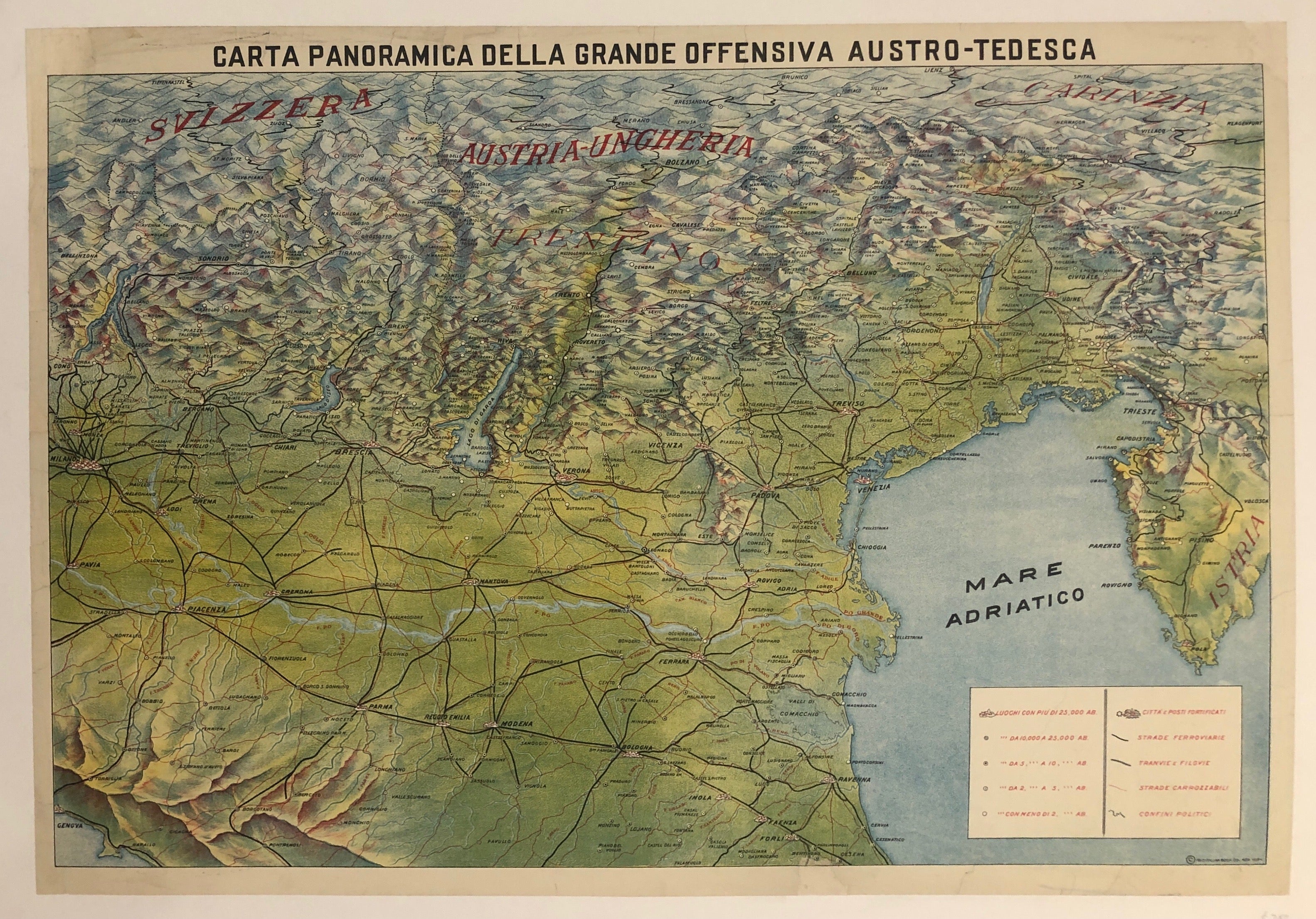
Carta Panoramica della Grande Offensiva Austro-Tedesca ✓
France, c. 191722 x 31 in (56 x 79 cm)
ID #LBFRENCHTRAVELTABLE02-L-137
Translation: Overview map of the Great Austro-German Offensive
This original Italian map is for war historians and map-lovers alike. Showing an aerial view of Switzerland and Austria-Hungary, it depicts the region of an offensive strategy by German soldiers during World War I.
Artist/Printer: Italian Cook Co., New York
Please note this is linen-backed on canvas.
Condition: Good
LBFRENCHTRAVELTABLE02-#137


