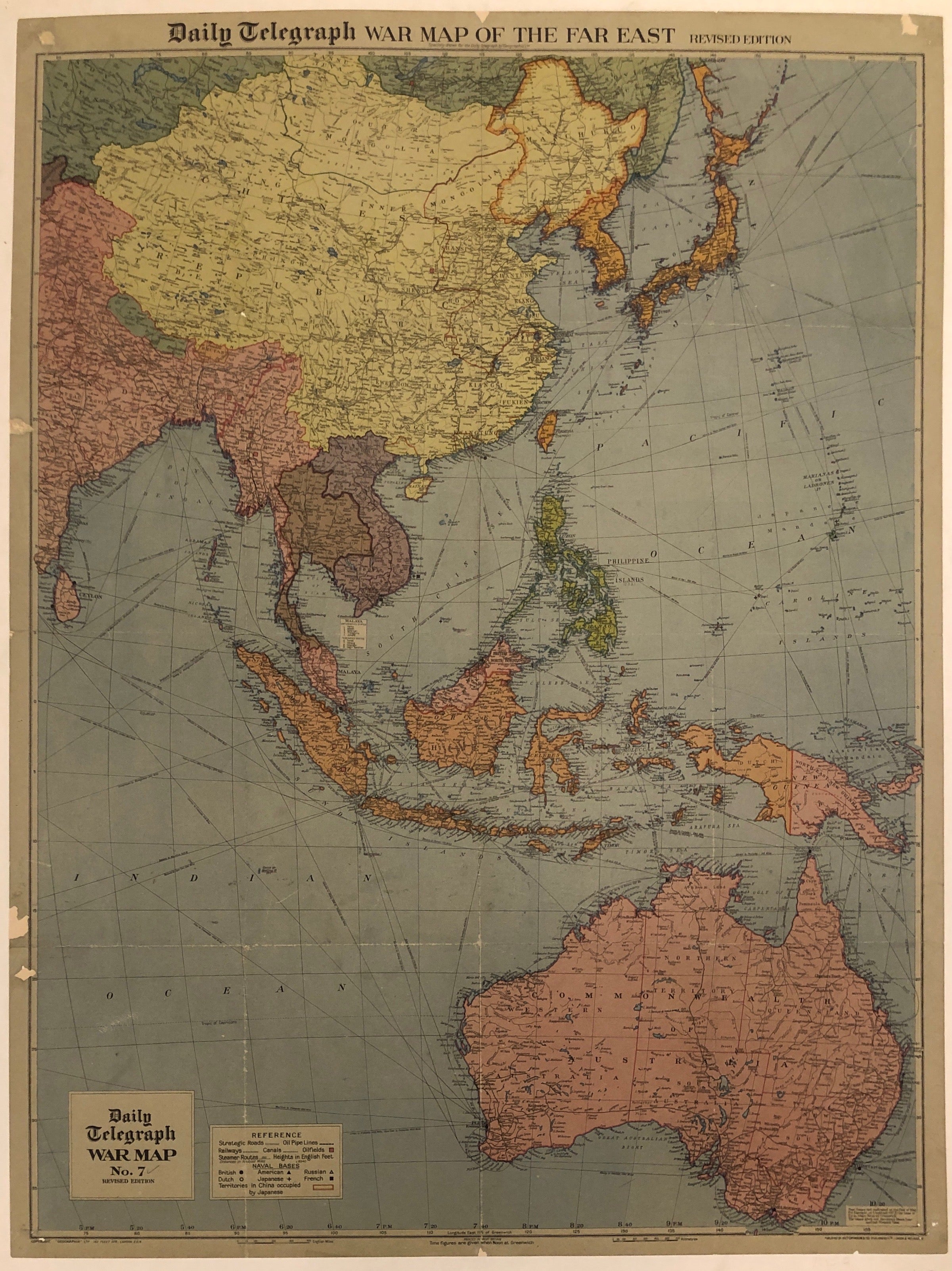
War Map Of The Far East ✓
United Kingdom, c.194232 x 42 in (81 x 107 cm)
ID #LBFRENCHTRAVELTABLE02-L-03
This remarkable piece of history was number seven in a series of war maps published by the Daily Telegraph, a London journal. It shows naval bases in Asia as well as borders, railways, and Japanese occupation.
Printer: Hutchinson & Co.
Condition: Fair, has small pieces missing and folds
Please note this is linen-backed on canvas.
LBFRENCHTRAVELTABLE02-#03