10 Transportation

NOTE: For close-up of condition, double-click the image
Link to  Aeronautical Route Chart, Windsor-Quebec, Canada (Double-Sided)1963  Product
Aeronautical Route Chart, Windsor-Quebec, Canada (Double-Sided) Product Link
1963
52 x 16 in (132 x 39 cm)
$90
Link to  Aeronautical Route Chart, Montreal-Goose Bay, Canada (Double-Sided)1967  Product
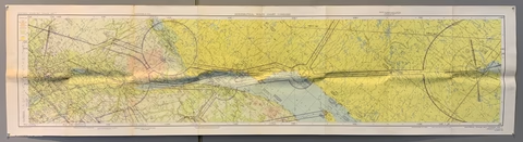
Aeronautical Route Chart, Montreal-Goose Bay, Canada (Double-Sided) Product Link
1967
60 x 16 in (152 x 39 cm)
$90
Link to  Aeronautical Route Chart, Yarmouth-Gander, Canada (Double-Sided)1963  Product
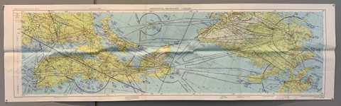
Aeronautical Route Chart, Yarmouth-Gander, Canada (Double-Sided) Product Link
1963
52 x 16 in (132 x 39 cm)
$90
Link to  Canadian Aeronautical Information Map, Magdalen Islands-Charlottetown (Double-Sided)1972  Product
Canadian Aeronautical Information Map, Magdalen Islands-Charlottetown (Double-Sided) Product Link
1972
30 x 26 in (76 x 65 cm)
$90
Link to  Canadian Aeronautical Information Map, Fredericton-Moncton (Double-Sided)1972  Product
Canadian Aeronautical Information Map, Fredericton-Moncton (Double-Sided) Product Link
1972
30 x 26 in (76 x 65 cm)
$90
Link to  Canadian Department of Energy, Mines, and Resources Aeronautical Information Map (Double-Sided)1972  Product
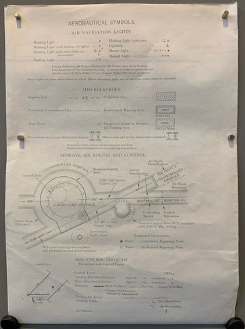
Canadian Department of Energy, Mines, and Resources Aeronautical Information Map (Double-Sided) Product Link
1972
36 x 25 in (90 x 64 cm)
$90
Link to  Canada World Aeronautical Chart (Double-Sided)1971  Product
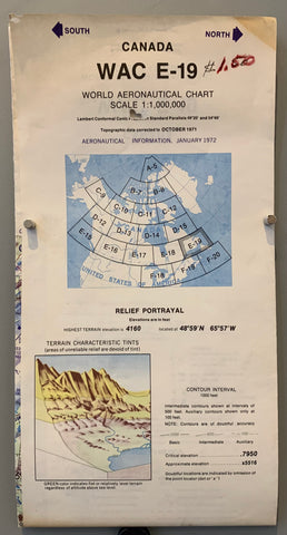
Canada World Aeronautical Chart (Double-Sided) Product Link
1971
50 x 20 in (127 x 51 cm)
$90
Link to  IFR Enroute Low Altitude (U.S.), 1986 (Double-Sided)1986  Product
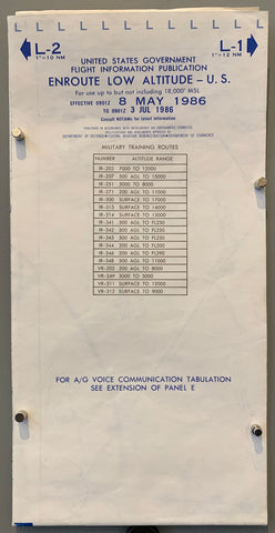
IFR Enroute Low Altitude (U.S.), 1986 (Double-Sided) Product Link
1986
50 x 20 in (127 x 51 cm)
$90
Link to  IFR Enroute Low Altitude (U.S.), 1985 (Double-Sided)1985  Product
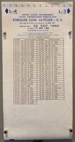
IFR Enroute Low Altitude (U.S.), 1985 (Double-Sided) Product Link
1985
49 x 20 in (124 x 51 cm)
$90
Link to  The Austin "Seven"  Product
The Austin "Seven" Product Link
25 x 40 in (64 x 102 cm)
$450