112 All Posters

NOTE: For close-up of condition, double-click the image
Link to  The Earth Wall Chart1955  Product
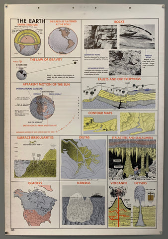
The Earth Wall Chart Product Link
1955
42 x 29 in (107 x 74 cm)
$300
Link to  Vue du Centre de Paris à Vol d'Oiseau PosterFrance, 1954  Product
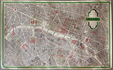
Vue du Centre de Paris à Vol d'Oiseau Poster Product Link
France, 1954
22 x 48 in (56 x 122 cm)
$350
Link to  Air France Flight Map PosterFrance, 1953  Product
Air France Flight Map Poster Product Link
France, 1953
33 x 49 in (84 x 124 cm)
$200
Link to  WW2 Allied Air Offensive Bombing Map PosterCanada, c. 1941  Product
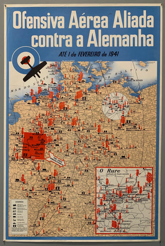
WW2 Allied Air Offensive Bombing Map Poster Product Link
Canada, c. 1941
30 x 20 in (76 x 51 cm)
$450
Link to  Unser Vormarsch im Osten Tatsachen gegen Lügen PosterGermany, c. 1941  Product
Unser Vormarsch im Osten Tatsachen gegen Lügen Poster Product Link
Germany, c. 1941
33 x 24 in (84 x 61 cm)
$550
Link to  Mappa Geographica Regionem Mexicanam et Floridam PosterGermany, c. 1730  Product
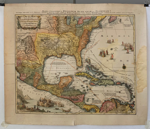
Mappa Geographica Regionem Mexicanam et Floridam Poster Product Link
Germany, c. 1730
22 x 25 in (56 x 64 cm)
$2,000
Link to  Harbors of Plymouth, Kingston, and Duxbury PosterU.S.A, c. 1960  Product
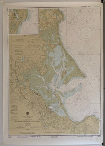
Harbors of Plymouth, Kingston, and Duxbury Poster Product Link
U.S.A, c. 1960
49 x 29 in (124 x 74 cm)
$150
Link to  New London Harbor MapU.S.A, c. 1960  Product
New London Harbor Map Product Link
U.S.A, c. 1960
49 x 29 in (124 x 74 cm)
$150
Link to  St. Helena Sound to Savannah River PosterU.S.A, c. 1960  Product
St. Helena Sound to Savannah River Poster Product Link
U.S.A, c. 1960
45 x 37 in (114 x 94 cm)
$150
Link to  L'Oriflamme ✓France  Product
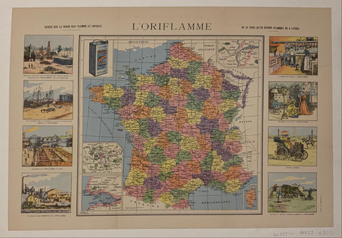
L'Oriflamme ✓ Product Link
France
23 x 16 in (58 x 41 cm)
$300
Link to  Carte Des Provinces Unies Des Pays Bas Map ✓France, c. 1700  Product
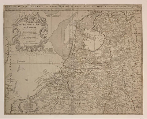
Carte Des Provinces Unies Des Pays Bas Map ✓ Product Link
France, c. 1700
21 x 24 in (53 x 61 cm)
$400
Link to  "Daichi no mi" (Directions)Japan c. 2010  Product
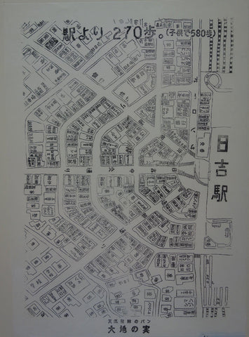
"Daichi no mi" (Directions) Product Link
Japan c. 2010
22 x 32 in (56 x 81 cm)
$300