Harbors of Plymouth, Kingston, and Duxbury Poster
U.S.A, c. 196049 x 29 in (124 x 74 cm)
ID #ROLLDWN05A-Z-03
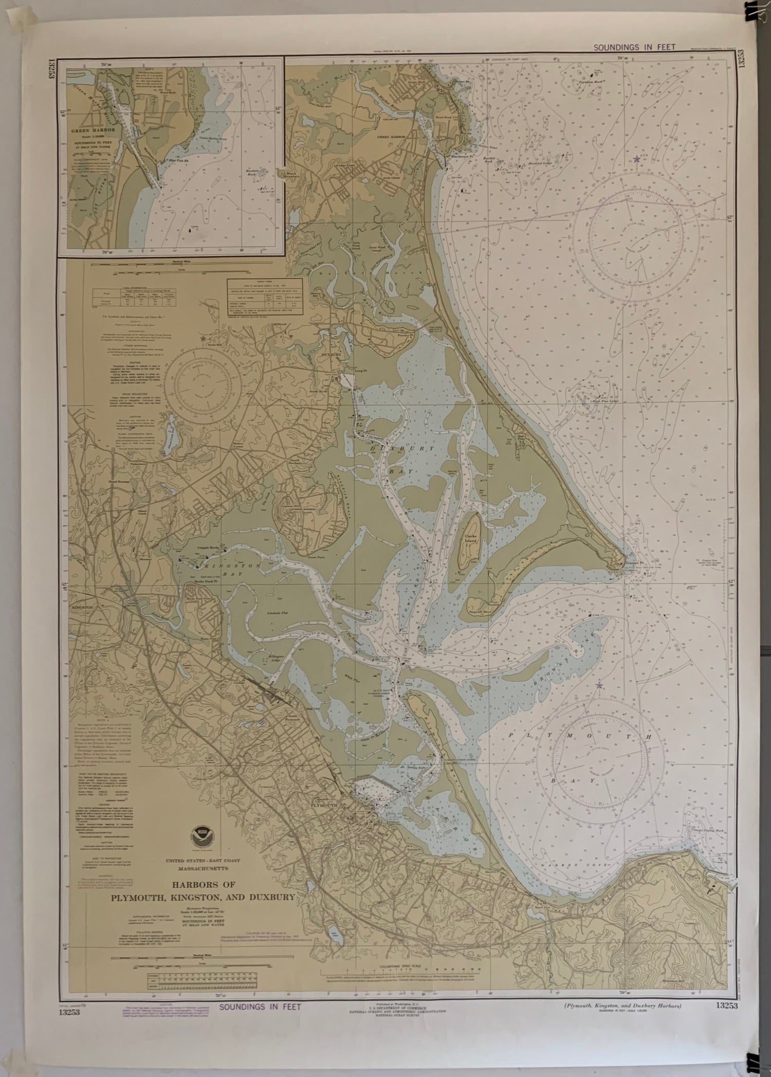
Vintage map of the Plymouth, Kingston, and Duxbury Harbors along the Massachusetts coast. The map illustrates the many islands off the coastline, offering a complete picture of this New England getaway.
Published in Washington D.C., U.S. Department of Commerce
Year: c. 1960
Condition: Good
This poster is on paper, but please note that we offer linen-backing for an additional cost. Email us at postermuseum@gmail.com to inquire more.


