109 All Posters
CATEGORY
PRICE
SIZE

Plan de Paris à vol d'oiseau Product Link
France, 1974
69 x 47 in (175 x 119 cm)
$275

Riviera Côte d'Azur Product Link
France, c. 1930s
39 x 24 in (99 x 61 cm)
$600

Arruolamenti 1957 (Paper) Product Link
Italy, 1956
47 x 33 in (119 x 84 cm)
$250

Scheepvaart Museum Amsterdam Product Link
Netherlands, c. 1950s
45 x 32 in (114 x 81 cm)
$250

Une Course d'Automobiles à Travers La Belgique Product Link
France, c. 1920s
18 x 21 in (46 x 53 cm)
$125

Conterminous United States Product Link
USA, 1973
29 x 41 in (74 x 104 cm)
$150

Air France Product Link
France, C.1950's
30 x 43 in (76 x 109 cm)
$2,200

Lo Stato Senese dopo la conquista medicea 1555-1609 Product Link
Italy, 1960s (?)
39 x 27 in (99 x 69 cm)
$300

La Belgique par Provinces Product Link
France, C.1920's
9 x 12 in (23 x 30 cm)
$90

Map of the Burlington Route Product Link
U.S.A., C.1890's
15 x 18 in (38 x 46 cm)
$90

Messageries Maritimes sur les routes de l'Union Française Product Link
France, c.1950's
39 x 25 in (99 x 64 cm)
$700

Map of the London Midland and Scottish Railway Product Link
UK, c. 1925
40 x 25 in (102 x 64 cm)
$450

Compagnies Fabre & Fraissinet Product Link
France, c. 1930
46 x 34 in (117 x 86 cm)
$850
Franconia World Cruise Product Link
United Kingdom, 1932
31 x 39 in (79 x 99 cm)
$600
Quelques Voyages Récents de Bâtiments de Guerre Product Link
France, 1954
29 x 42 in (74 x 107 cm)
$1,200

KLM Product Link
France, 1949
25 x 39 in (64 x 99 cm)
$600

Crédit Lyonnais Product Link
France, c. 1950
41 x 30 in (104 x 76 cm)
$450
Carte d'Afrique du Nord Product Link
France, c. 1950
25 x 39 in (64 x 99 cm)
$525

La Vallée de la Dordogne Product Link
France, 1948
32 x 47 in (81 x 119 cm)
$600

Les Châteaux de la Loire Product Link
France, c. 1930
32 x 43 in (80 x 108 cm)
$600
In China Max's Kansas City Product Link
USA, 1979
18 x 14 in (46 x 36 cm)
$250

ZEMĚPISNÉ TABULE.4 Product Link
Czech Republic, c. 1900
37 x 24 in (94 x 61 cm)
$400

Credit Lyonnais Map Product Link
France, c.1950's
41 x 30 in (104 x 76 cm)
$600

Africa Map Win #1 Product Link
Ghana, 2023
43 x 25 in (109 x 64 cm)
$200

Africa Map Win #2 Product Link
Ghana, 2023
37 x 26 in (94 x 66 cm)
$200
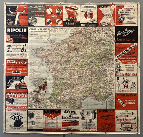
Carte de France Cartes Taride Product Link
France, c. 1930
47 x 49 in (119 x 124 cm)
$450

The Misguided Product Link
France C. 1910
26 x 95 in (66 x 241 cm)
$6,000
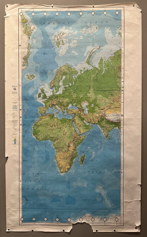
Map of Europe and Africa Product Link
USA, 1980
57 x 34 in (145 x 86 cm)
$150
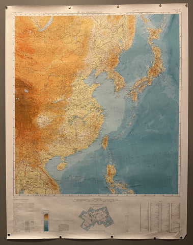
Map of Southeastern Asia Product Link
USA, c. 1940s
45 x 35 in (114 x 89 cm)
$150
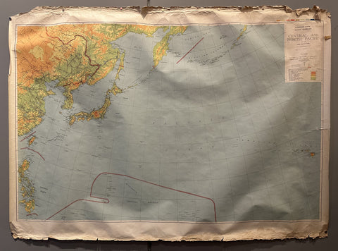
Map of Central and North Pacific Region Product Link
USA, 1943
44 x 59 in (112 x 150 cm)
$150
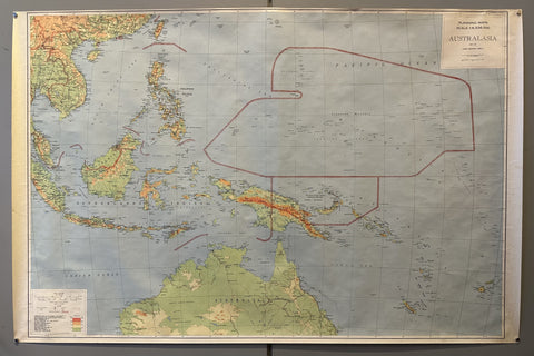
Map of Australasia Product Link
USA, 1943
38 x 58 in (97 x 147 cm)
$150
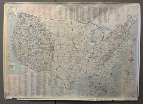
Major Army, Navy and Air Force Installations in the United States Product Link
USA, 1980
35 x 45 in (89 x 114 cm)
$150

Map of East Asia Product Link
USA, 1980
59 x 44 in (150 x 112 cm)
$150
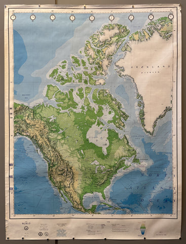
Map of North America Product Link
USA, 1980
59 x 44 in (150 x 112 cm)
$150

Subscribe to War Loans Product Link
Germany, 1917
22 x 19 in (56 x 48 cm)
$300
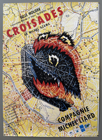
Croisades de Michel Azama Product Link
France, 1989
47 x 34 in (119 x 86 cm)
$400
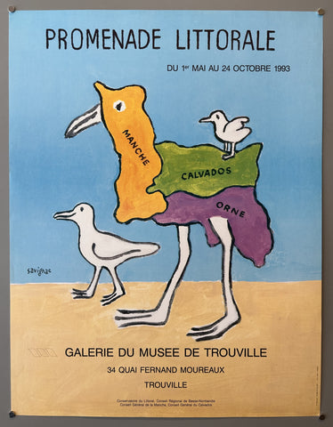
Promenade Littoral Product Link
France, 1986
25 x 20 in (64 x 51 cm)
$350
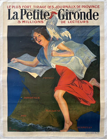
La Petite Gironde 3 Millions de Lecteurs Product Link
France, c. 1900
64 x 48 in (163 x 122 cm)
$650

Air France Map Summer 1952 Product Link
France, 1952
21 x 31 in (53 x 79 cm)
$250
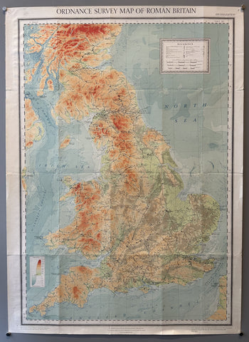
Ordnance Survey Map of Roman Britain Product Link
Great Britain, c. 1928
35 x 25 in (89 x 64 cm)
$200

Madagascar Museum d'Histoire Naturelle Product Link
France, c. 1946
48 x 30 in (122 x 76 cm)
$300

Stratford-Upon-Avon Product Link
United Kingdom, c. 1920s
22 x 27 in (56 x 69 cm)
$90
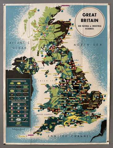
Great Britain Natural and Industrial Resources Poster Product Link
USA, 1944
40 x 30 in (102 x 76 cm)
$300
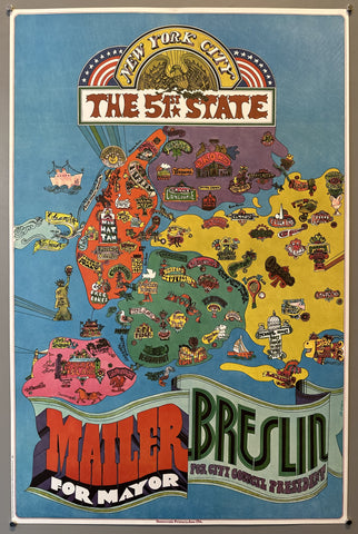
New York City The 51st State Product Link
United States, 1969
38 x 24 in (97 x 61 cm)
$200
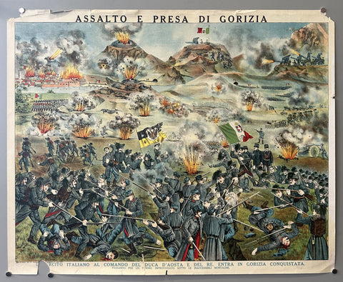
Assalto e Presa di Gorizia Product Link
NY, c. 1917
21 x 26 in (53 x 66 cm)
$300
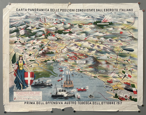
Carta Panoramica Delle Posizioni Conquistate dall'Esercito Italiano Product Link
NY, c. 1917
21 x 27 in (53 x 69 cm)
$300
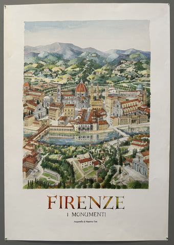
Monuments of Florence Labeled Poster Product Link
Italy, 2001
40 x 28 in (102 x 71 cm)
$200
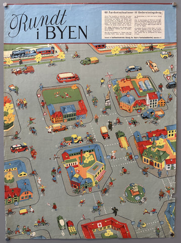
Rundt i Byen Poster Product Link
Denmark, c. 1960s
27 x 20 in (69 x 51 cm)
$175
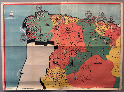
Map of Northern Spain Product Link
Spain, 1939
40 x 55 in (102 x 140 cm)
$800
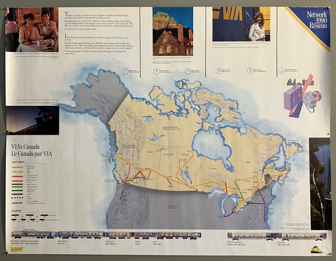
VIA'S Canada Poster Product Link
Canada, 1990

