28 All Posters
CATEGORY
PRICE
SIZE

Plan de Paris à vol d'oiseau Product Link
France, 1974
69 x 47 in (175 x 119 cm)
$275
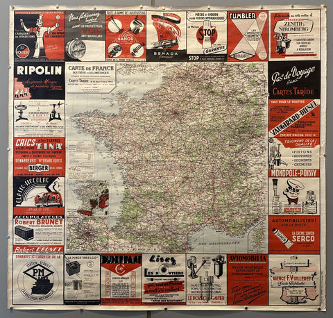
Carte de France Cartes Taride Product Link
France, c. 1930
47 x 49 in (119 x 124 cm)
$450
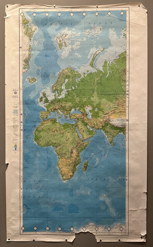
Map of Europe and Africa Product Link
USA, 1980
57 x 34 in (145 x 86 cm)
$150
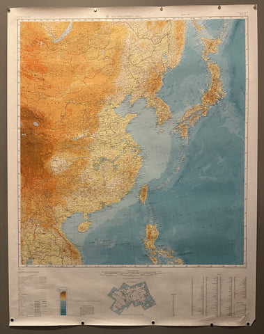
Map of Southeastern Asia Product Link
USA, c. 1940s
45 x 35 in (114 x 89 cm)
$150
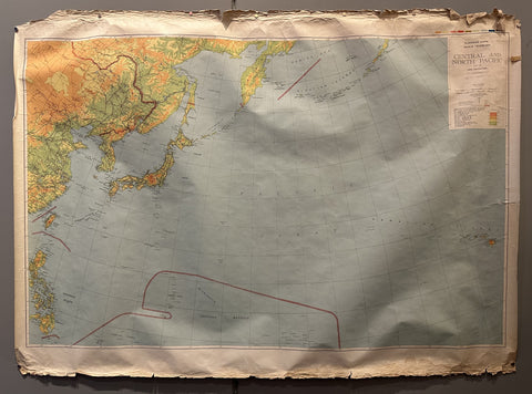
Map of Central and North Pacific Region Product Link
USA, 1943
44 x 59 in (112 x 150 cm)
$150
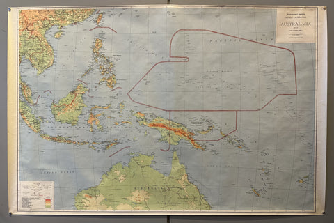
Map of Australasia Product Link
USA, 1943
38 x 58 in (97 x 147 cm)
$150
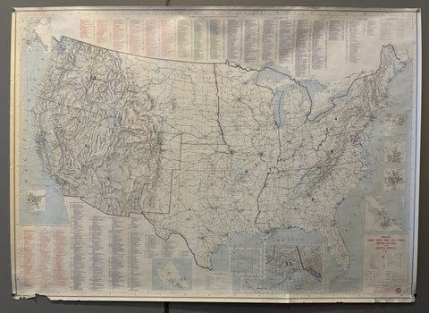
Major Army, Navy and Air Force Installations in the United States Product Link
USA, 1980
35 x 45 in (89 x 114 cm)
$150

Map of East Asia Product Link
USA, 1980
59 x 44 in (150 x 112 cm)
$150
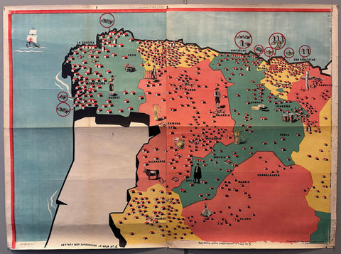
Map of Northern Spain Product Link
Spain, 1939
40 x 55 in (102 x 140 cm)
$800
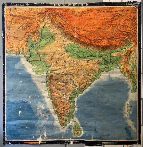
Sudasien Map Product Link
Germany, c. 1950
76 x 71 in (193 x 180 cm)
$100
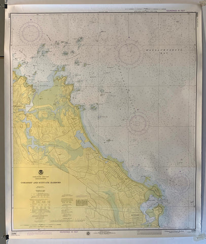
NOAA Cohasset and Scituate Harbors Map Product Link
U.S.A., 1975
42 x 35 in (107 x 89 cm)
$200
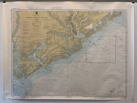
NOAA Charleston Harbor and Approaches Map Product Link
U.S.A., 1962
36 x 44 in (91 x 112 cm)
$200
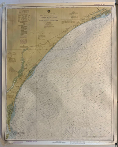
NOAA Little River Inlet to Winyah Bay Entrance Map Product Link
U.S.A., 1979
36 x 44 in (91 x 112 cm)
$200
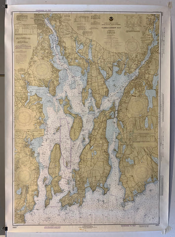
NOAA Narrangansett Bay Map Product Link
U.S.A., 1979
44 x 36 in (112 x 91 cm)
$200
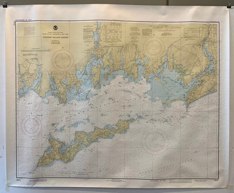
NOAA Fishers Island Sound Map Product Link
U.S.A., 1979
37 x 45 in (94 x 114 cm)
$200
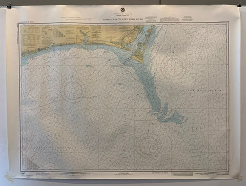
NOAA Approaches to Cape Fear River Map Product Link
U.S.A., 1979
37 x 45 in (94 x 114 cm)
$200
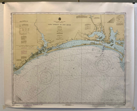
NOAA Cape Lookout to New River Map Product Link
U.S.A., 1981
37 x 45 in (94 x 114 cm)
$200
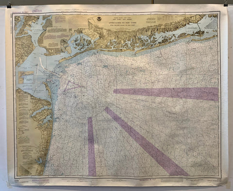
NOAA Approaches to New York Map Product Link
U.S.A., 1979
36 x 48 in (91 x 122 cm)
$200
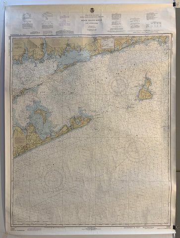
NOAA Block Island Sound and Approaches Map Product Link
U.S.A., 1960
48 x 36 in (122 x 91 cm)
$200

Harpers weekly January 4 1862 Product Link
U.S.A., 1862
15 x 11 in (37 x 28 cm)
$40

Harpers Weekly April 26 1862 Product Link
U.S.A., 1862
15 x 11 in (37 x 28 cm)
$40

Harper's Weekly, 26 April 1862 Product Link
U.S.A., 1862
15 x 11 in (38 x 28 cm)
$40

Shelter Island Map Product Link
U.S.A, 1988
106 x 36 in (269 x 91 cm)
$125
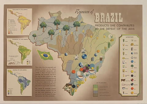
Resources of Brazil Poster ✓ Product Link
Brazil, c. 1944
14 x 20 in (36 x 51 cm)
$150
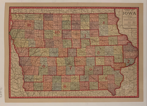
Map Of Iowa ✓ Product Link
USA, c. 1917
17 x 23 in (43 x 58 cm)
$90
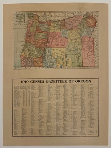
Census Gazetteer Of Oregon ✓ Product Link
USA, c. 1910
18 x 224 in (46 x 569 cm)
$125
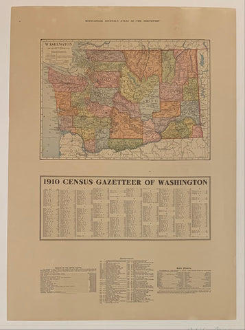
Minneapolis Journal's Atlas of "The Northwest": Washington Product Link
USA, c. 1910
18 x 24 in (46 x 61 cm)
$65
New Jersey Map Product Link
USA, 1967

