

IFR Enroute Low Altitude (U.S.), 1985 (Double-Sided)
198549 x 20 in (124 x 51 cm)
ID #MAPDRAWER-2D-PK4-2S
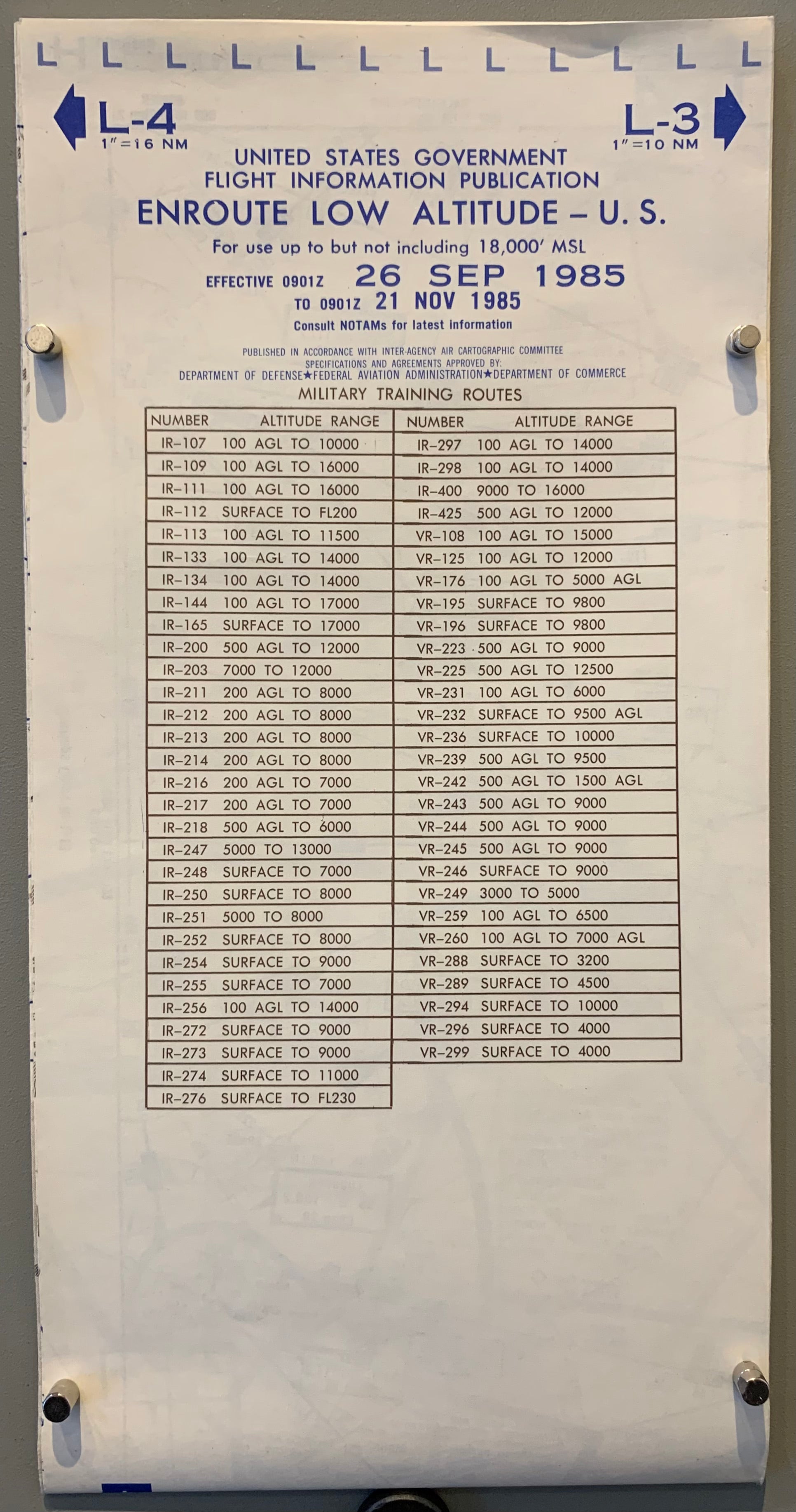
Title: United States Government Flight Information Publication, Enroute Low Altitude - U.S.
Description: Instrument Flight Rules (IFR) Enroute Low Altitude Charts are designed to provide information regarding navigation during flights below 18,000 feet MSL. These colored charts also typically include air traffic services, cruising altitudes, and military training routes. Relevant information for days between 26 September 1985 to 21 November 1985.
Published: Inter-Agency Air Cartographic Committee. Data approved by Department of Defense, Federal Aviation Administration, and Department of Commerce.
Condition: Folds.


