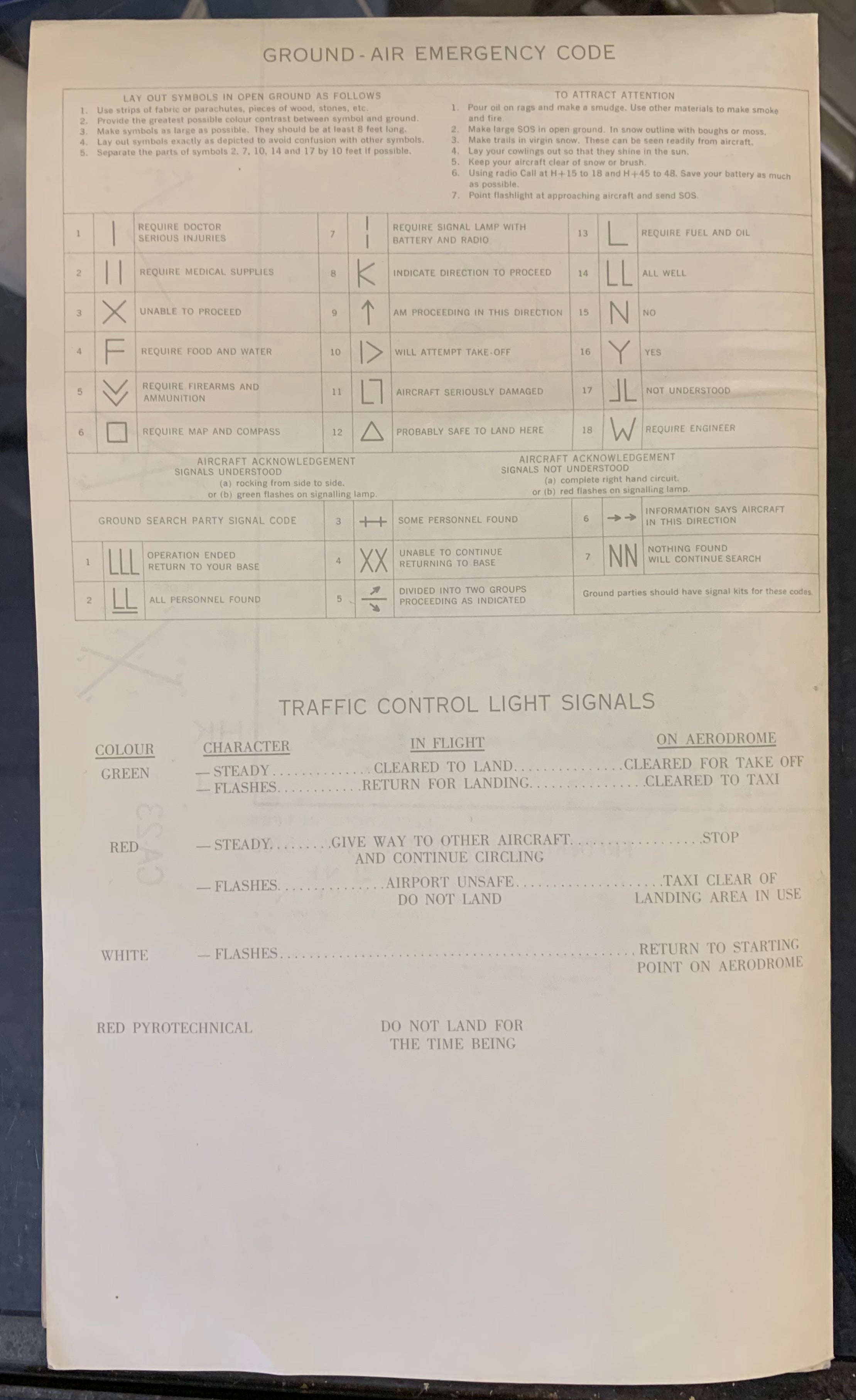


Canadian Aeronautical Information Map, Fredericton-Moncton (Double-Sided)
197230 x 26 in (76 x 65 cm)
ID #MAPDRAWER-2D-PK5-2S
Title: Canadian Department of Mines and Technical Surveys Aeronautical Information Map - Fredericton-Moncton
Description: A folded map/pamphlet of aeronautical symbols, including air navigation lights, airways, air routes, and contol, and air emergency codes. On the other side of the print is a fully-colored aeronautical map of the Fredericton-Moncton area produced by Canada's Department of Mines and Technical Surveys.
Publisher: Canada Department of Mines and Technical Surveys; Surveys and Mapping Branch
Condition: Folds.


