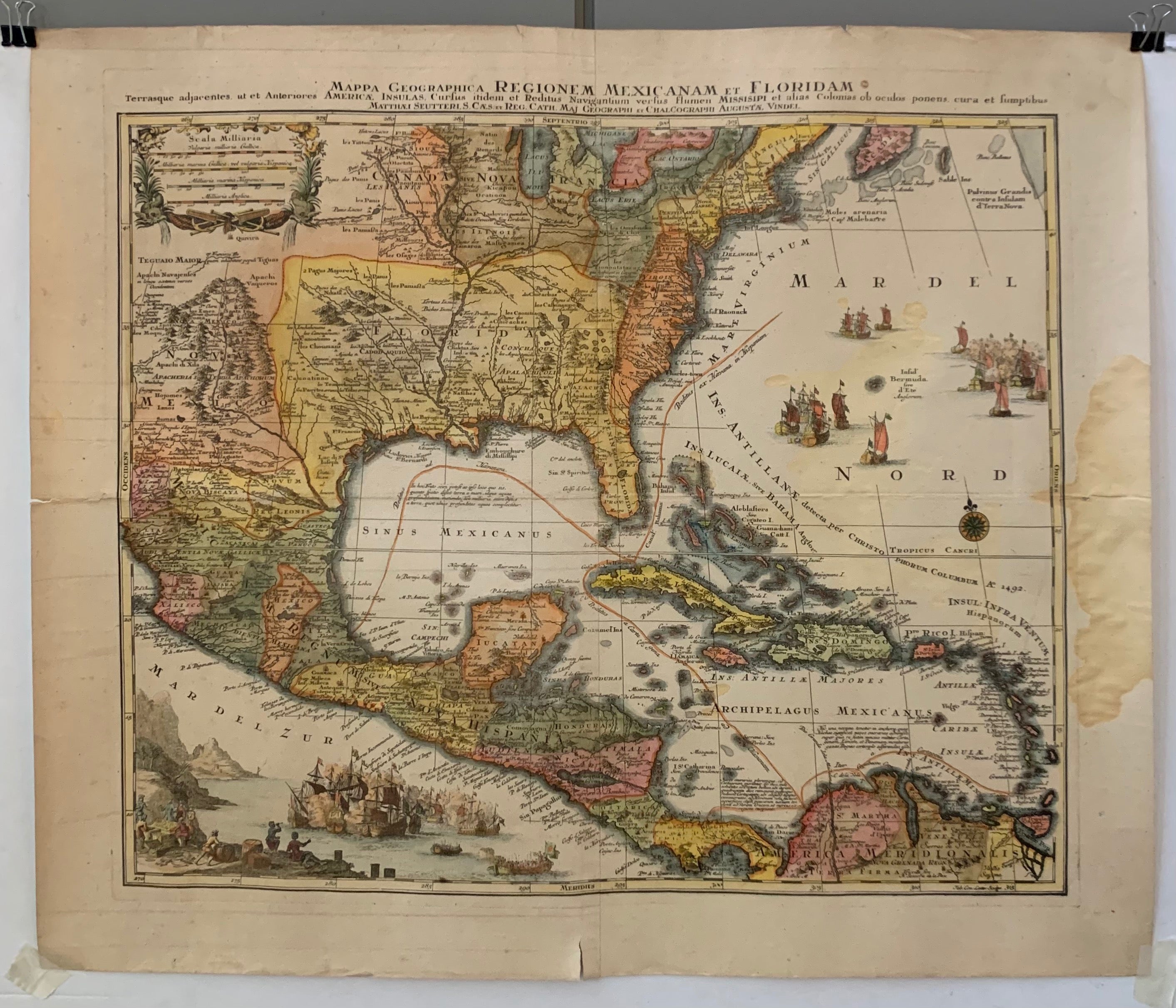
Mappa Geographica Regionem Mexicanam et Floridam Poster
Germany, c. 173022 x 25 in (56 x 64 cm)
ID #ROLLDWN-Z-38A
Vintage map by a German cartographer illustrating France, Spain, and England's colonial territories. The map has a regal air to it: the text is all written in Latin, even going to the length of "Latinizing" the names Florida and Mexico—places the Ancient Romans probably never got around to naming. The details on the map really demonstrate the master craftsmanship of 18th Century cartographers. The naval battle scene illustrated in the bottom left corner of the map adds a personal touch that today's mass-produced maps can never replicate.
"Tarrasque adjacentes ut et Anteriores America Insulas, Curfus itdem et Reditus Navingatium verfus flumen Missisipi et alias Colonias ob ocudos ponens cura et fumptibus."
Cartographer: Matthaus Seutter
Printed in Augsburg, Germany
Year: c. 1730
Condition: Fair, please note water damage along the right-hand border and some minor tears along the border. The appearance of tears and damage can be improved by having the poster linen-backed.
This poster is on paper, but please note that we offer linen-backing for an additional cost. Email us at postermuseum@gmail.com to inquire more.


